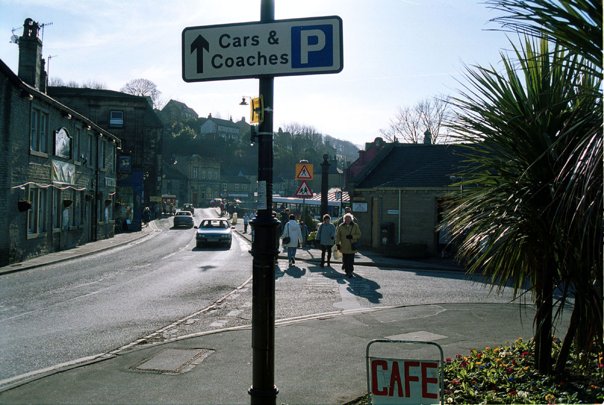
Road into HOLMFIRTH last of the summer wine capital.
Looking around our modern day landscape it becomes quite obvious that we, and our world are being manipulated by the media. Our world is being turned upside down by that same media, changing the shape of the landscape and country, giving rise to such places as BRONTE, CONSTABLE and COOKSON country to name but a few, myths designed to encourage tourism and consequential commercial and financial gain. A myth created in this way can and does cause conflict within reality, making the myth appear more real than the real, leaving us in a state of bewilderment, not knowing what fits where and why, all generated by a media intent on reshaping the landscape, and creating public awareness to a point where, the old and the new are brought together to create a different place, a place of make believe, totally embroiled in its media representation, and visited each year by thousands of tourists, tourists who, on arrival at this place, appear to have no sense of real time, and are it would seem prepared to embark on a kind of journey in time. Public and private transport reinforces this feeling of dreaminess with posters and advertisements incorporating images of the idyllic landscape outside, for which they are heading, strategically placed giving a sense of adventure and belonging.
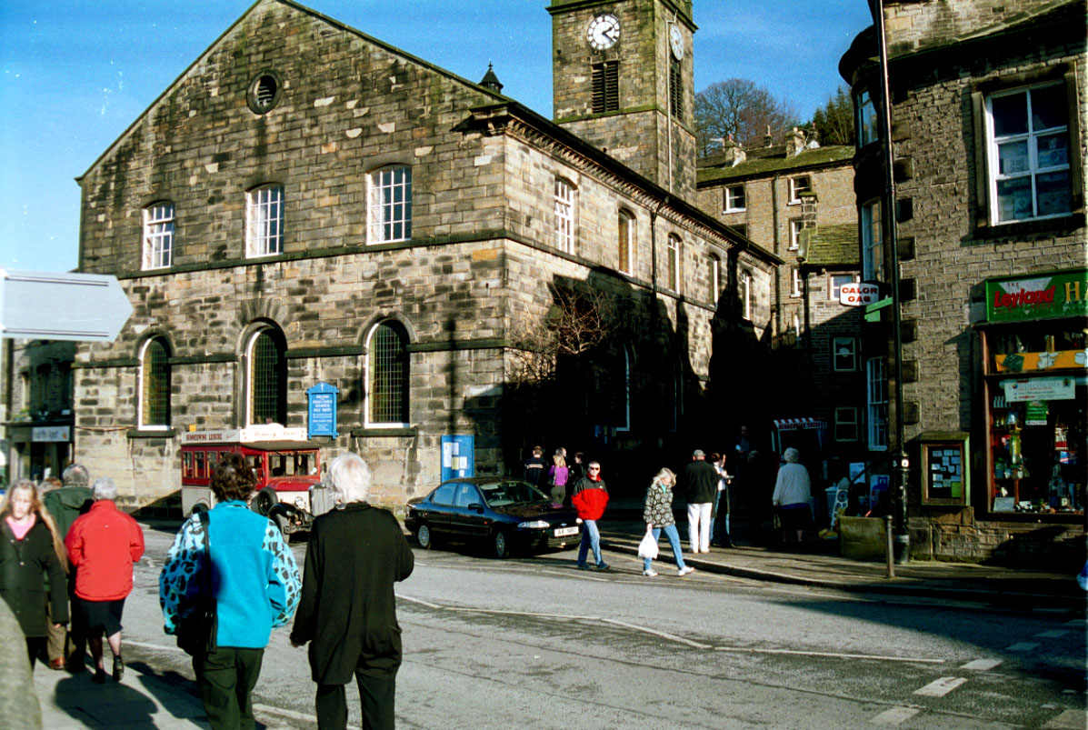
Tourists arriving for the authentic tour Charabanc.
Tourist charabanc loaded with tourists and ready for the off, on the tour of a liftime.
The media represent England as a cosy little place in total harmony with nature, filling their travel guides and coffee table books with images of late Victorian England at ease with life, take for example Stratford – on – Avon, this place has history in its own right, and has been a talismanic place since the mid nineteenth century, through media manipulation and tourism it has now become “Shakespeare Country” with perhaps the only contemporary entity being Ann Hathaway’s cottage a anachronism in a landscape reshaped for commercial gain, produced for tourists who gaze in bewilderment, having no thoughts of the hardships of contemporary times, time being of no importance now, in their metaphysical state and thereby extinguished by an imagined community,
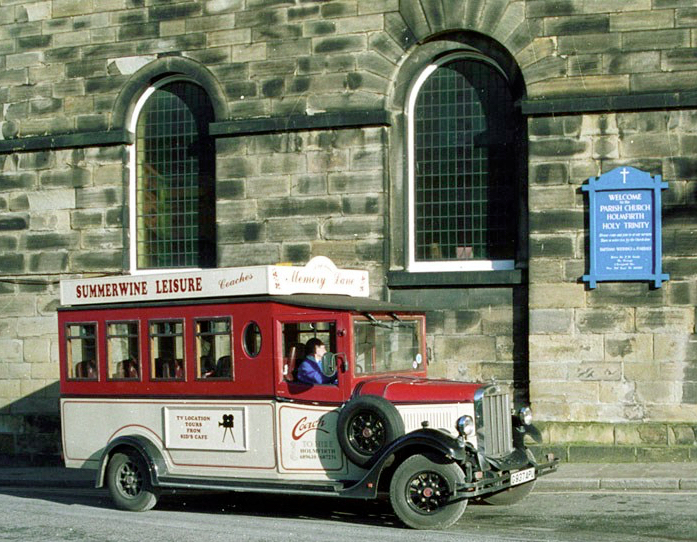
The ice cream seller taking time out until the Charabanc returns from its tour of “SUMMER WINE COUNTRY” in the holm valley.
Since time is man made and effects only everyday schedules and routines, for example work, bus and train time tables etc, to the tourist it has no significance, leaving them free to absorb themselves in the events and pleasures of the day and, since the landscape does not stop for dinner this can be a perpetual gazing or looking. John Taylor explains this activity with reference to works by Norman Bryson who considers gazing, looking and glancing to be different and separate activities ie. a gaze being a steady absorption of information where a glance is a furtive consideration of the landscape without the absorption, and looking an interactivity between the two a trait tourists have unwittingly acquired, thereby seeing and absorbing only the part of the landscape of interest to them, and whilst the rest may warrant a glance, nothing is absorbed for later reference.
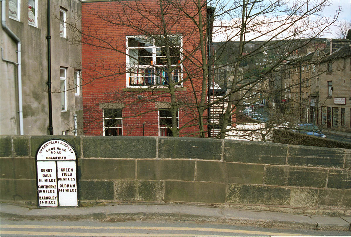
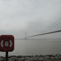
Hump back bridge into the village
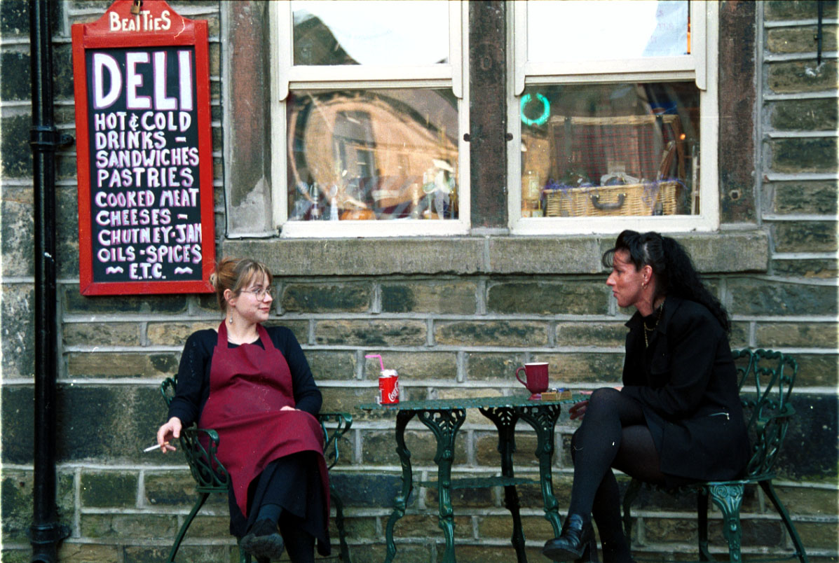
Having a well deserved drink.
Since time is man made and effects only everyday schedules and routines, i.e work, bus and train time tables etc, to the tourist it has no significance, leaving them free to absorb themselves in the events and pleasures of the day and, since the landscape does not stop for dinner this can be a perpetual gazing or looking. John Taylor explains this activity with reference to works by Norman Bryson who considers gazing, looking and glancing to be different and separate activities ie. a gaze being a steady absorption of information where a glance is a furtive consideration of the landscape without the absorption, and looking an interactivity between the two a trait tourists have unwittingly acquired, thereby seeing and absorbing only the part of the landscape of interest to them, and whilst the rest may warrant a glance nothing is absorbed for later reference
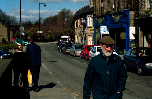
Local people going about their business.
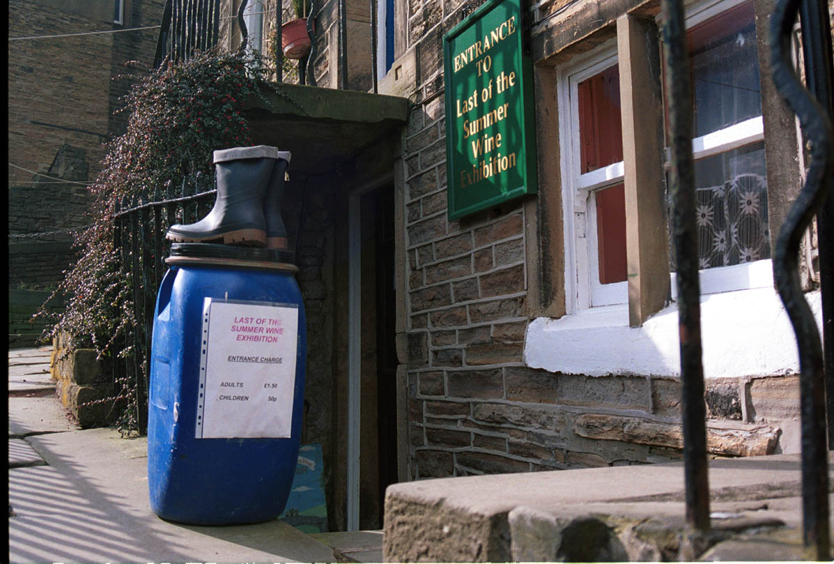
The whole object of the visit is to be part of this way of life, and they flit from venue to venue gazing at what is now reality. A private dwelling at the top of a flight of stone steps, once a venue for the cottage industry mentioned before, and inconspicuous for years, is now miraculously Nora Batty’s cafe, from where Compo had a bucket of water spilled over him, and where hundreds of photographs are taken by tourists to authenticate their visit, photographs that can be looked at time and time again in the comfort of their own home enabling them to relive the experience of “Summer Wine Country.” A signifier confirming this to be the right place, are a pair of Wellington boots synonymous with the character “Compo” and a sign promoting the Wrinkled Stocking Tea Rooms, wrinkled stockings being a characteristic of Nora Batty’s dress code implying their hero’s as it were are on the premises, all of this will be immobilised in celluloid, as a reminder to them of the momentous occasion which, in their present state of mind has become a reality of which they are a part, what is not noticed is the dereliction adjacent to it, because this is not part of their reality, nor is the book shop to the other side, and, whilst these places are afforded a glance, they are not subjects of their world and therefore they are secondary and uncompromising of their reality.
Nora Batties café
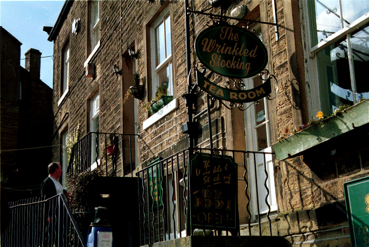
Nora Batties Wrincled stocking.
Strolling along the road they know so well, mentally reliving the scene they see a milestone, a signifier which confirms this is still Summer Wine country, without which the spell would be broken, a clever ploy in reshaping the landscape and keeping the myth alive, until further along the road juxtaposed in the Summer Wine Landscape by the side of it’s river is a Italian restaurant causing ambivalence in the mind of the tourist and, situated next to a car park provided for those tourists visiting in their own transport, but it is given only a glance as the tourists are brought back on track by the vision of the fish & chip shop, a more fitting place for Summer Wine Country folk, ahead of the chippy in this make believe world is Joe’s cafe, situated in the church square. The signifier here is a life sized model of Compo standing outside the door to the cafe, authenticating the place to the tourist as the correct place to be at this juncture of his visit. The enterprising owner of joe’s cafe, jumping on the band wagon of this popular fictitious country, provides for the tourist a authentic charabanc to transport them to an extension of the country where other popular media created frivolities take place, like a pint at “The White Horse” in Jackson Bridge another small Pennine village embroiled in a media manufactured world, above which lie a row of cottages characteristic of, and no doubt are weavers cottages of a past era, until this became Summer Wine Country and they became Foggy’s house. This place is some five miles from Holmfirth but the trip there in the charabanc dose not deter the tourist from his fantasy and reality of Summer Wine Country.
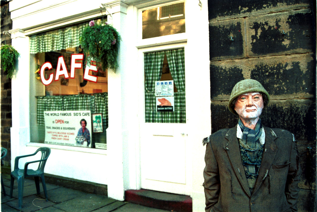
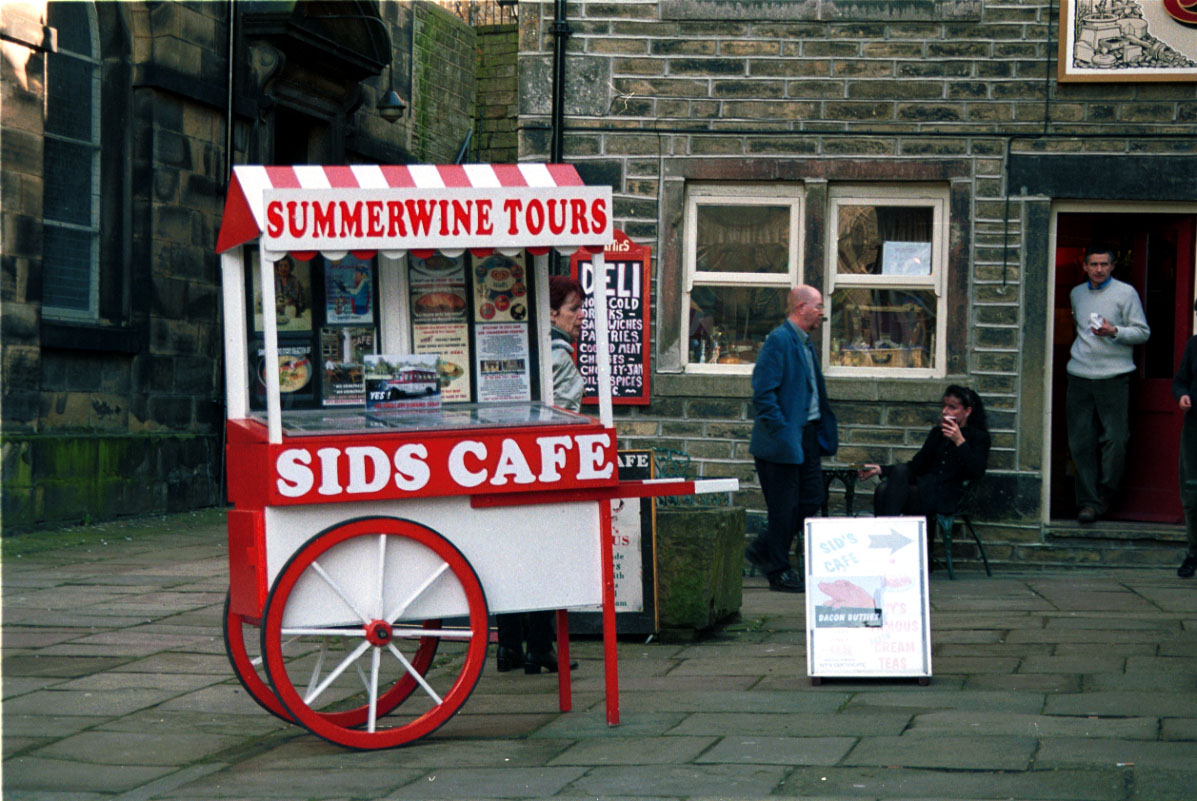
Sid’s café situated in the parish Church yard in the centre of Holmfirth.
John Taylor, in his book ‘A Dream of England’ endeavours to explain that travelling in time in this way, implies a sort of mortality, and at the same time, death giving pleasure in retrospect to tourists seeking a talismanic place in which to escape the pressures of present day life, thus creating a sense of belonging, comfort and conformation of a past existence, and by producing photographs of their visit reinforces that conformation. Camera’s says Roland Barthes quote “are clocks for seeing into the dead past” thus producing images with a stopped in time feeling about them’ creating a feeling of nostalgia within the voyeur.
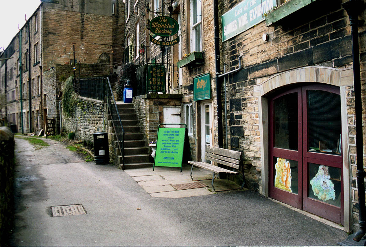
The street where the famous “NORA BATTIES” Café is, nobody really sees the dereliction of the textile building next door.
The Parish Church yard containing Sid’s café in the right corner, with the village ironmongers next door.
Taylor also refers to this reshaping of the landscape as being history reduced to heritage and a commodity put up for sale, not implying history has no foundation but rather heritage as no foundation, or stability, exhibiting only the things that promote safety and security in an ideological way, for securing and conserving our passed. He also states that English Heritage and the National Trust argue that their entertainment and exhibitions programme take away the sense of continuity and replace it with a feeling of a presence in time, or a stop in history, which in itself creates a feeling of nostalgia.
The deindustrialisation of mainly the north, by the Thatcherism within the Conservative Party who’s political decisions closed traditional manufacturing industries, such as mines, steel works, engineering companies and textile mills to name but a few have destroyed a way of life, but ironically another has been created in spite of it, namely English Heritage who purport to show it as it was, but in a postmodernist way within a reshaped landscape manipulated to those ends in the name of profit. employing redundant locals as guides because of their infinite knowledge and personal authenticity. Ambiguous or what !
Places manipulated in a way that Beamish in the North East has been, give a false impression of a place recognisably situated in a “modern” industrial environment of notoriously difficult times, smoothed by a sense of community within the structure and manipulated in a way as to imply idyllic ways of life in the past, and yet people have a affinity with it, giving them a sense of belonging, and how ever difficult the past, the reshaping of the landscape reinforces the myth as more real than the real, dissolving past memories and experiences into oblivion and making the present the reality of the past, a postmodern simulacrum manipulated to give a sketchy look at Northern industrial history, but in reality a decontextualised history, mixed with the postmodern ideas to produce a pastiche of past living history, to be exploited and promoted for capital gain, reproduced in photographs and on calendars and thermos flasks and many other such paraphernalia.
This postmodern idea of hyper-reality, the more real than real, the invented reality, created from the modern and ironically, operating within the modern industrial structure, creates confusion in a society coming to terms with the collapse of the manufacturing industry, needless to say these new innovations need to be informed, not only for their own success, but to capture the interests of the skeptics. The changes brought about is a media generated, visual culture, covering most aspects of sociological and industrial life as it was in the past, to represent this past life in a way that can be interesting and more to the point, acceptable to the public at large.
The postmodern takes it’s lead from Romanticism, which, in itself holds an historical background, a background with a belief that unlike the doctrines of Neoclassicism, Romanticism was subjective, a fascination with the qualities of nature, heightened awareness, and visionary interest in colour for it’s symbolistic properties. Having faith in the beauty of nature and it’s natural subjects, gave rise to having the same faith in it’s representation, this according to Jean Baudrillard is the fundamental requirement for the postmodernist movement, where a signifier can represent a meaning so long as the meaning can be guaranteed, i.e a recognisably authentic sign, like the ones mentioned earlier like the model of Compo and the sign above Nora Batty’s tea shop.
Many modern day photographers and critics insist “real England” is only to be found in newspapers and photographic exhibitions, exhibitions by photographers who don’t go along with the pretty little England scenario. Oppositional photographers such as Alison Marchant, Ingrid Pollard, Peter Turley concern themselves with the way they see history in England being hijacked to distort the market forces and encourage tourists to seek out the picturesque, making photographs of a style futile to tourism and the media’s manipulated world, but seek to dislocate and disturb rather than create the sociably acceptable, such images as Constables “Haywain” complete with cruise missiles, by Peter Kennard, an image synonymous with the romantic England and the idyll of the country side before the advent of industry and the inclusion of the missiles causing a discord in that belief, implying England is not what the media would have us believe. Other oppositional photographers i.e. Martin Parr, Karen Knorr and John Kippin rather than a critical look at the country as a whole, they concern themselves with the plight of the northern working class, a class according to The book“Flogging a dead horse” by photographer Paul Reas who is not dead, and against nostalgia and cutting of heritage. The heritage of the working classes can be attributed from the fact that, the whole thing revolves around the flat cap and braces brigade, artefacts of hard work and social deprivation immediately recognisable in the exhibitions and heritage centres in the North and Midlands.
On the other hand stately homes and picturesque landscape gardens expel wealth to a point that the tourist of a working class background can feel somewhat out of place, not knowing if this is his English heritage or that of something or somebody unknown, thus keeping the idea of a class system alive.
Malcolm S Firth BA(Hons) ARPS
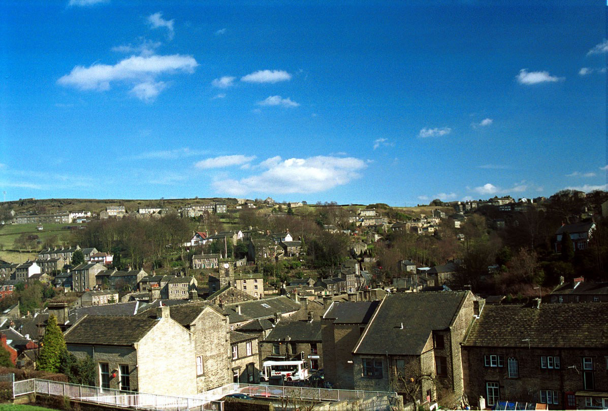
HOLMFIRTH from the top of the valley, not a view many tourists will see on their visit to “SUMMER WINE COUNTRY”
All the images in this work were made by M S Firth (BA Hons)ARPS and in analogue format on Kodak colour film, Scanned and digitalised to Apple Mac computer.


 The centre of the walled town of Certaldo with the ubiquitous church and restaurants
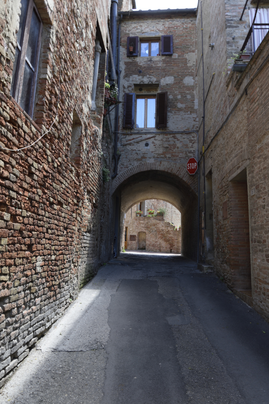
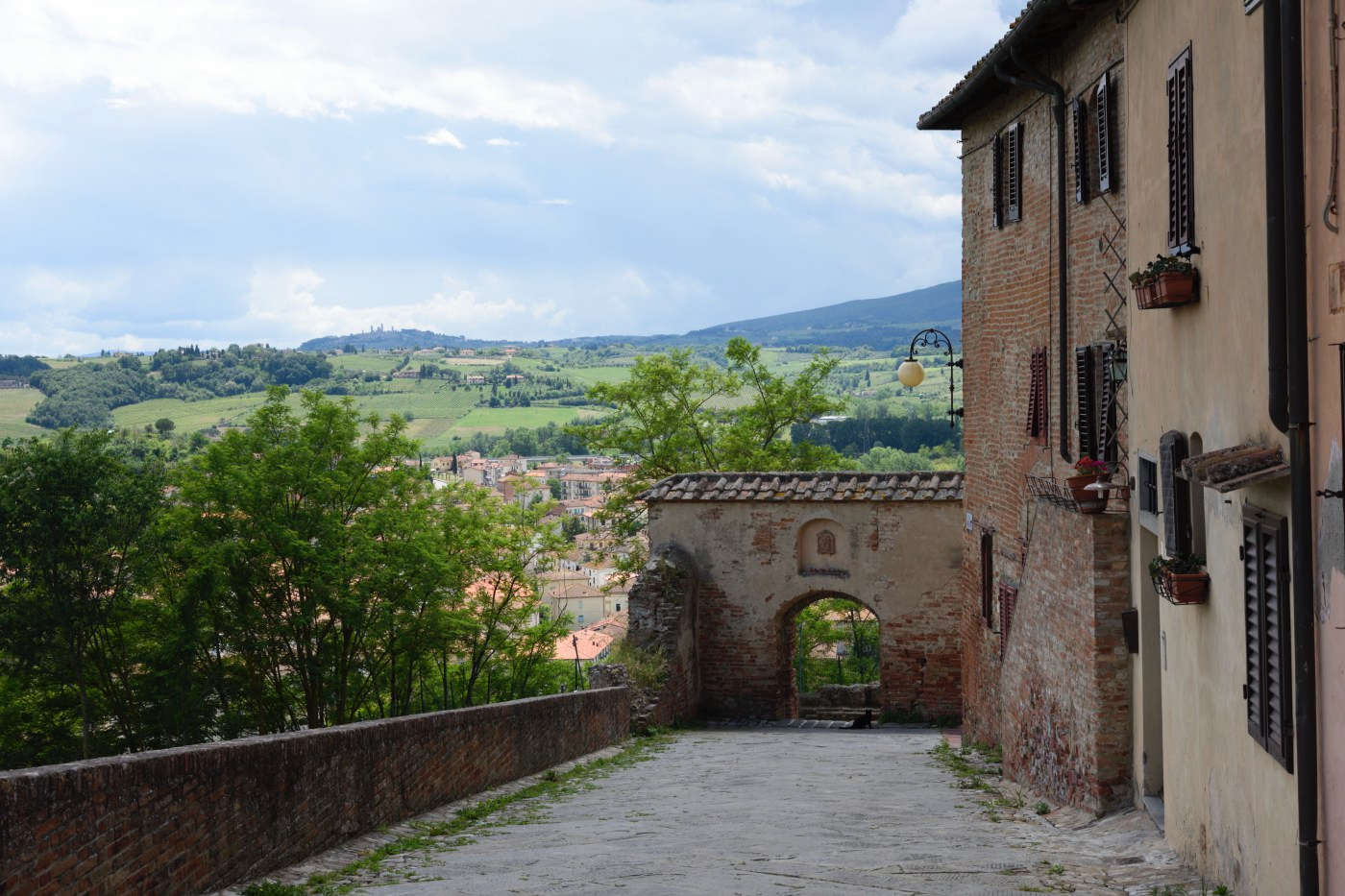
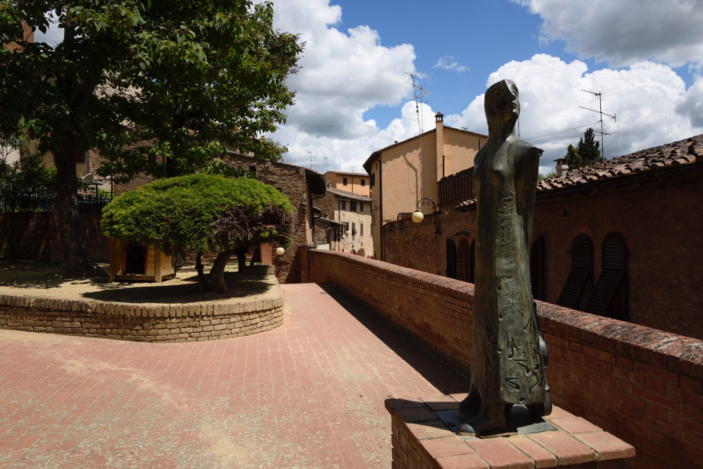


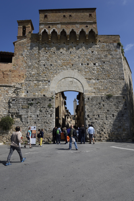

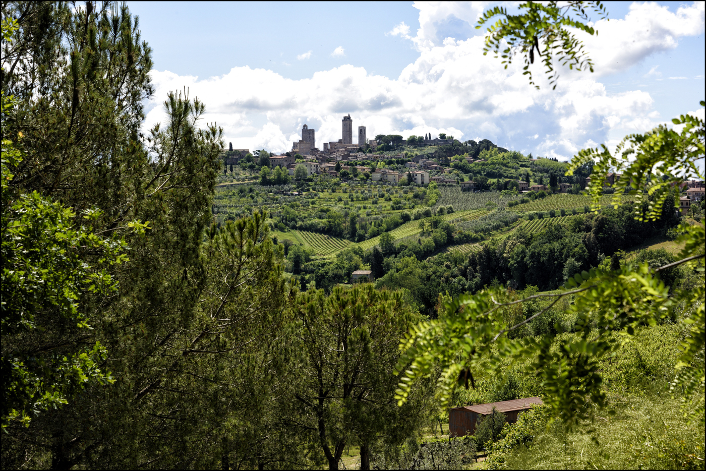
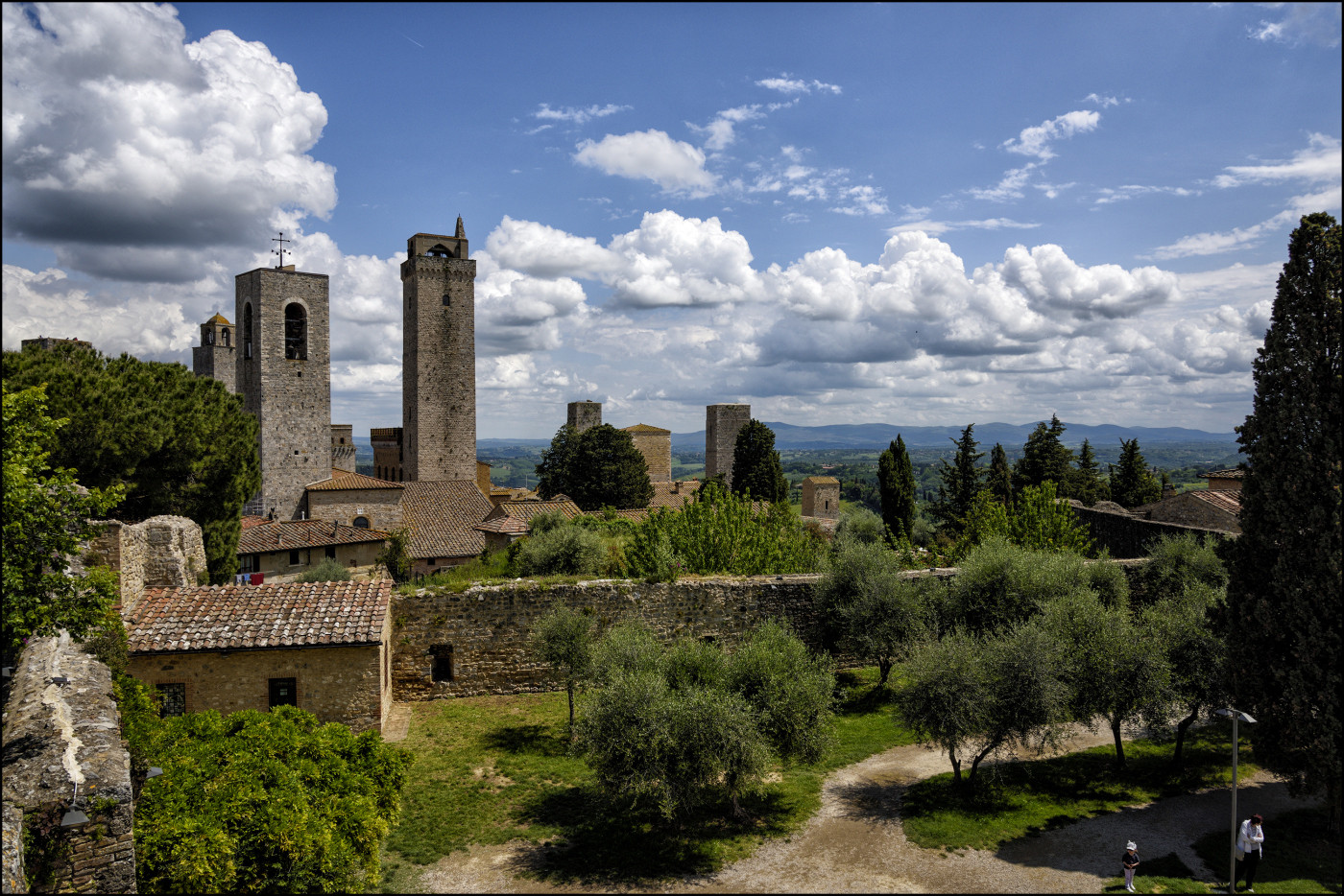
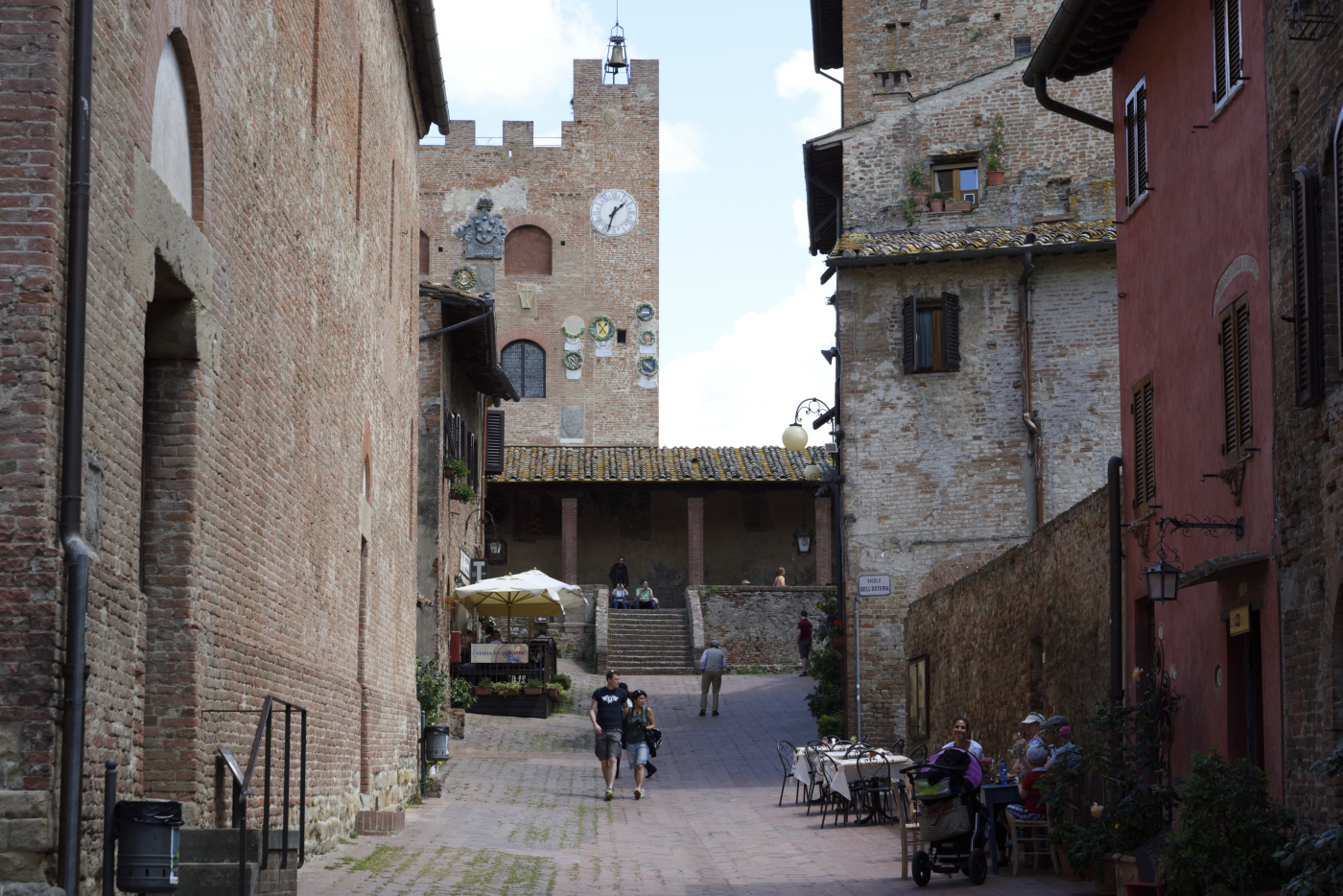
![San Gimignano is a small walled medieval hill town in the province of Siena, Tuscany, north-central Italy. Known as the Town of Fine Towers, San Gimignano is famous for its medieval architecture, unique in the preservation of about a dozen of its tower houses, which, with its hilltop setting and encircling walls form "an unforgettable skyline". Within the walls, the well-preserved buildings include notable examples of both Romanesque and Gothic architecture, with outstanding examples of secular buildings as well as churches. The Palazzo Comunale, the Collegiate Church and Church of Sant' Agostino contain frescos, including cycles dating from the 14th and 15th centuries.[2] The "Historic Centre of San Gimignano", is a UNESCO World Heritage Site. The town also is known for the saffron, the Golden Ham and its white wine, Vernaccia di San Gimignano, produced from the ancient variety of Verna PROVINCE OF SIENA Population (31 May 2009) Ê¥ÊTotal 270,333 The Province of Siena (Italian: Provincia di Siena) is a province in the Tuscany region of Italy. Its capital is the city of Siena. Geography The province is divided into seven historical areas: 1. Alta Val d'Elsa 2. Chianti senese 3. The urban area of (Monteriggioni and Siena) 4. Val di Merse 5. Crete senesi Val d'Arbia 6. Val di Chiana senese 7. Val d'Orcia and Amiata The area is a hilly one: in the north is Colline del Chianti; Monte Amiata is the highest point at 1,738 metres (5,702Êft); and in the south is Monte Cetona. To the west are the Colline Metallifere (ÒMetallic HillsÓ), whilst the Val di Chiana lies to east. Historically, the province corresponds to the former Republic of Siena. The chief occupations are agricultural (wheat, grapes and fruit) and silk culture. The wine known as Chianti is produced here as well as in other parts of Tuscany: the Chianti Colli Senesi, however, is limited to this province. Apart from the city of Siena the principal towns are Poggibonsi, Colle di Val d'Elsa, Montepulciano.](https://malcsf.files.wordpress.com/2017/06/san-gimignano_019.jpg?w=328&resize=328%2C219#038;h=219 "SAN GIMIGNANO")
![San Gimignano is a small walled medieval hill town in the province of Siena, Tuscany, north-central Italy. Known as the Town of Fine Towers, San Gimignano is famous for its medieval architecture, unique in the preservation of about a dozen of its tower houses, which, with its hilltop setting and encircling walls form "an unforgettable skyline". Within the walls, the well-preserved buildings include notable examples of both Romanesque and Gothic architecture, with outstanding examples of secular buildings as well as churches. The Palazzo Comunale, the Collegiate Church and Church of Sant' Agostino contain frescos, including cycles dating from the 14th and 15th centuries.[2] The "Historic Centre of San Gimignano", is a UNESCO World Heritage Site. The town also is known for the saffron, the Golden Ham and its white wine, Vernaccia di San Gimignano, produced from the ancient variety of Verna PROVINCE OF SIENA Population (31 May 2009) Ê¥ÊTotal 270,333 The Province of Siena (Italian: Provincia di Siena) is a province in the Tuscany region of Italy. Its capital is the city of Siena. Geography The province is divided into seven historical areas: 1. Alta Val d'Elsa 2. Chianti senese 3. The urban area of (Monteriggioni and Siena) 4. Val di Merse 5. Crete senesi Val d'Arbia 6. Val di Chiana senese 7. Val d'Orcia and Amiata The area is a hilly one: in the north is Colline del Chianti; Monte Amiata is the highest point at 1,738 metres (5,702Êft); and in the south is Monte Cetona. To the west are the Colline Metallifere (ÒMetallic HillsÓ), whilst the Val di Chiana lies to east. Historically, the province corresponds to the former Republic of Siena. The chief occupations are agricultural (wheat, grapes and fruit) and silk culture. The wine known as Chianti is produced here as well as in other parts of Tuscany: the Chianti Colli Senesi, however, is limited to this province. Apart from the city of Siena the principal towns are Poggibonsi, Colle di Val d'Elsa, Montepulciano.](https://malcsf.files.wordpress.com/2017/06/san-gimignano_022.jpg?w=328&resize=328%2C219#038;h=219 "SAN GIMIGNANO")
![San Gimignano is a small walled medieval hill town in the province of Siena, Tuscany, north-central Italy. Known as the Town of Fine Towers, San Gimignano is famous for its medieval architecture, unique in the preservation of about a dozen of its tower houses, which, with its hilltop setting and encircling walls form "an unforgettable skyline". Within the walls, the well-preserved buildings include notable examples of both Romanesque and Gothic architecture, with outstanding examples of secular buildings as well as churches. The Palazzo Comunale, the Collegiate Church and Church of Sant' Agostino contain frescos, including cycles dating from the 14th and 15th centuries.[2] The "Historic Centre of San Gimignano", is a UNESCO World Heritage Site. The town also is known for the saffron, the Golden Ham and its white wine, Vernaccia di San Gimignano, produced from the ancient variety of Verna PROVINCE OF SIENA Population (31 May 2009) Ê¥ÊTotal 270,333 The Province of Siena (Italian: Provincia di Siena) is a province in the Tuscany region of Italy. Its capital is the city of Siena. Geography The province is divided into seven historical areas: 1. Alta Val d'Elsa 2. Chianti senese 3. The urban area of (Monteriggioni and Siena) 4. Val di Merse 5. Crete senesi Val d'Arbia 6. Val di Chiana senese 7. Val d'Orcia and Amiata The area is a hilly one: in the north is Colline del Chianti; Monte Amiata is the highest point at 1,738 metres (5,702Êft); and in the south is Monte Cetona. To the west are the Colline Metallifere (ÒMetallic HillsÓ), whilst the Val di Chiana lies to east. Historically, the province corresponds to the former Republic of Siena. The chief occupations are agricultural (wheat, grapes and fruit) and silk culture. The wine known as Chianti is produced here as well as in other parts of Tuscany: the Chianti Colli Senesi, however, is limited to this province. Apart from the city of Siena the principal towns are Poggibonsi, Colle di Val d'Elsa, Montepulciano.](https://malcsf.files.wordpress.com/2017/06/san-gimignano_057.jpg?w=444&resize=444%2C665#038;h=665 "SAN GIMIGNANO")
![San Gimignano is a small walled medieval hill town in the province of Siena, Tuscany, north-central Italy. Known as the Town of Fine Towers, San Gimignano is famous for its medieval architecture, unique in the preservation of about a dozen of its tower houses, which, with its hilltop setting and encircling walls form "an unforgettable skyline". Within the walls, the well-preserved buildings include notable examples of both Romanesque and Gothic architecture, with outstanding examples of secular buildings as well as churches. The Palazzo Comunale, the Collegiate Church and Church of Sant' Agostino contain frescos, including cycles dating from the 14th and 15th centuries.[2] The "Historic Centre of San Gimignano", is a UNESCO World Heritage Site. The town also is known for the saffron, the Golden Ham and its white wine, Vernaccia di San Gimignano, produced from the ancient variety of Verna PROVINCE OF SIENA Population (31 May 2009) Ê¥ÊTotal 270,333 The Province of Siena (Italian: Provincia di Siena) is a province in the Tuscany region of Italy. Its capital is the city of Siena. Geography The province is divided into seven historical areas: 1. Alta Val d'Elsa 2. Chianti senese 3. The urban area of (Monteriggioni and Siena) 4. Val di Merse 5. Crete senesi Val d'Arbia 6. Val di Chiana senese 7. Val d'Orcia and Amiata The area is a hilly one: in the north is Colline del Chianti; Monte Amiata is the highest point at 1,738 metres (5,702Êft); and in the south is Monte Cetona. To the west are the Colline Metallifere (ÒMetallic HillsÓ), whilst the Val di Chiana lies to east. Historically, the province corresponds to the former Republic of Siena. The chief occupations are agricultural (wheat, grapes and fruit) and silk culture. The wine known as Chianti is produced here as well as in other parts of Tuscany: the Chianti Colli Senesi, however, is limited to this province. Apart from the city of Siena the principal towns are Poggibonsi, Colle di Val d'Elsa, Montepulciano.](https://malcsf.files.wordpress.com/2017/06/san-gimignano_062.jpg?w=517&resize=517%2C345#038;h=345 "SAN GIMIGNANO")
![San Gimignano is a small walled medieval hill town in the province of Siena, Tuscany, north-central Italy. Known as the Town of Fine Towers, San Gimignano is famous for its medieval architecture, unique in the preservation of about a dozen of its tower houses, which, with its hilltop setting and encircling walls form "an unforgettable skyline". Within the walls, the well-preserved buildings include notable examples of both Romanesque and Gothic architecture, with outstanding examples of secular buildings as well as churches. The Palazzo Comunale, the Collegiate Church and Church of Sant' Agostino contain frescos, including cycles dating from the 14th and 15th centuries.[2] The "Historic Centre of San Gimignano", is a UNESCO World Heritage Site. The town also is known for the saffron, the Golden Ham and its white wine, Vernaccia di San Gimignano, produced from the ancient variety of Verna PROVINCE OF SIENA Population (31 May 2009) Ê¥ÊTotal 270,333 The Province of Siena (Italian: Provincia di Siena) is a province in the Tuscany region of Italy. Its capital is the city of Siena. Geography The province is divided into seven historical areas: 1. Alta Val d'Elsa 2. Chianti senese 3. The urban area of (Monteriggioni and Siena) 4. Val di Merse 5. Crete senesi Val d'Arbia 6. Val di Chiana senese 7. Val d'Orcia and Amiata The area is a hilly one: in the north is Colline del Chianti; Monte Amiata is the highest point at 1,738 metres (5,702Êft); and in the south is Monte Cetona. To the west are the Colline Metallifere (ÒMetallic HillsÓ), whilst the Val di Chiana lies to east. Historically, the province corresponds to the former Republic of Siena. The chief occupations are agricultural (wheat, grapes and fruit) and silk culture. The wine known as Chianti is produced here as well as in other parts of Tuscany: the Chianti Colli Senesi, however, is limited to this province. Apart from the city of Siena the principal towns are Poggibonsi, Colle di Val d'Elsa, Montepulciano.](https://malcsf.files.wordpress.com/2017/06/san-gimignano_070.jpg?w=255&resize=255%2C171#038;h=171 "SAN GIMIGNANO")
![San Gimignano is a small walled medieval hill town in the province of Siena, Tuscany, north-central Italy. Known as the Town of Fine Towers, San Gimignano is famous for its medieval architecture, unique in the preservation of about a dozen of its tower houses, which, with its hilltop setting and encircling walls form "an unforgettable skyline". Within the walls, the well-preserved buildings include notable examples of both Romanesque and Gothic architecture, with outstanding examples of secular buildings as well as churches. The Palazzo Comunale, the Collegiate Church and Church of Sant' Agostino contain frescos, including cycles dating from the 14th and 15th centuries.[2] The "Historic Centre of San Gimignano", is a UNESCO World Heritage Site. The town also is known for the saffron, the Golden Ham and its white wine, Vernaccia di San Gimignano, produced from the ancient variety of Verna PROVINCE OF SIENA Population (31 May 2009) Ê¥ÊTotal 270,333 The Province of Siena (Italian: Provincia di Siena) is a province in the Tuscany region of Italy. Its capital is the city of Siena. Geography The province is divided into seven historical areas: 1. Alta Val d'Elsa 2. Chianti senese 3. The urban area of (Monteriggioni and Siena) 4. Val di Merse 5. Crete senesi Val d'Arbia 6. Val di Chiana senese 7. Val d'Orcia and Amiata The area is a hilly one: in the north is Colline del Chianti; Monte Amiata is the highest point at 1,738 metres (5,702Êft); and in the south is Monte Cetona. To the west are the Colline Metallifere (ÒMetallic HillsÓ), whilst the Val di Chiana lies to east. Historically, the province corresponds to the former Republic of Siena. The chief occupations are agricultural (wheat, grapes and fruit) and silk culture. The wine known as Chianti is produced here as well as in other parts of Tuscany: the Chianti Colli Senesi, however, is limited to this province. Apart from the city of Siena the principal towns are Poggibonsi, Colle di Val d'Elsa, Montepulciano.](https://malcsf.files.wordpress.com/2017/06/san-gimignano_076.jpg?w=255&resize=255%2C170#038;h=170 "SAN GIMIGNANO")
![San Gimignano is a small walled medieval hill town in the province of Siena, Tuscany, north-central Italy. Known as the Town of Fine Towers, San Gimignano is famous for its medieval architecture, unique in the preservation of about a dozen of its tower houses, which, with its hilltop setting and encircling walls form "an unforgettable skyline". Within the walls, the well-preserved buildings include notable examples of both Romanesque and Gothic architecture, with outstanding examples of secular buildings as well as churches. The Palazzo Comunale, the Collegiate Church and Church of Sant' Agostino contain frescos, including cycles dating from the 14th and 15th centuries.[2] The "Historic Centre of San Gimignano", is a UNESCO World Heritage Site. The town also is known for the saffron, the Golden Ham and its white wine, Vernaccia di San Gimignano, produced from the ancient variety of Verna PROVINCE OF SIENA Population (31 May 2009) Ê¥ÊTotal 270,333 The Province of Siena (Italian: Provincia di Siena) is a province in the Tuscany region of Italy. Its capital is the city of Siena. Geography The province is divided into seven historical areas: 1. Alta Val d'Elsa 2. Chianti senese 3. The urban area of (Monteriggioni and Siena) 4. Val di Merse 5. Crete senesi Val d'Arbia 6. Val di Chiana senese 7. Val d'Orcia and Amiata The area is a hilly one: in the north is Colline del Chianti; Monte Amiata is the highest point at 1,738 metres (5,702Êft); and in the south is Monte Cetona. To the west are the Colline Metallifere (ÒMetallic HillsÓ), whilst the Val di Chiana lies to east. Historically, the province corresponds to the former Republic of Siena. The chief occupations are agricultural (wheat, grapes and fruit) and silk culture. The wine known as Chianti is produced here as well as in other parts of Tuscany: the Chianti Colli Senesi, however, is limited to this province. Apart from the city of Siena the principal towns are Poggibonsi, Colle di Val d'Elsa, Montepulciano.](https://malcsf.files.wordpress.com/2017/06/san-gimignano_120.jpg?w=776&resize=776%2C518#038;h=518 "SAN GIMIGNANO")
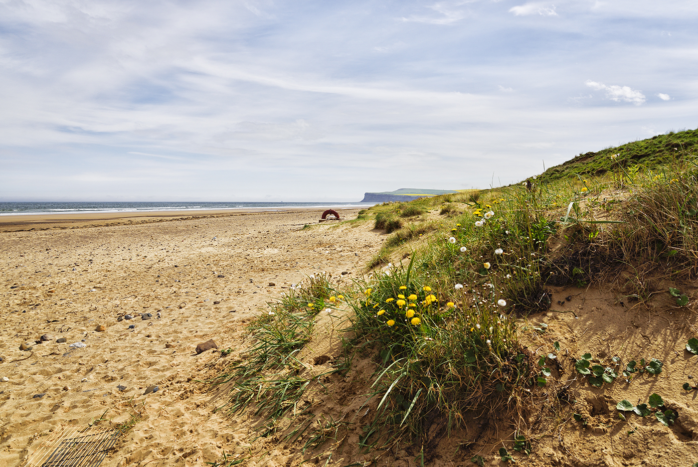
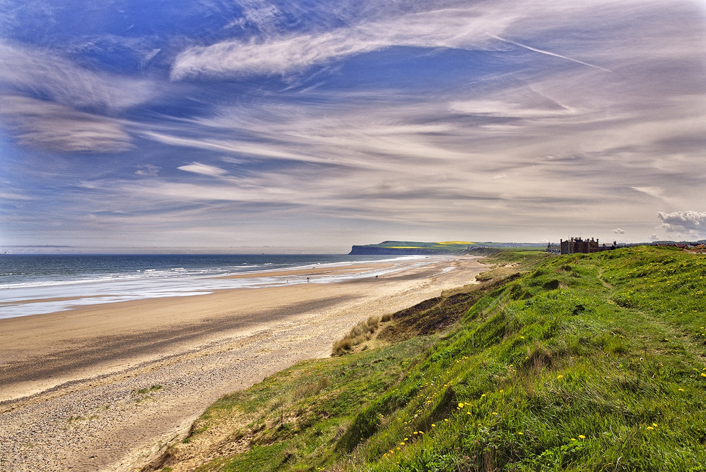
 The beach at Marske-By-the-Sea
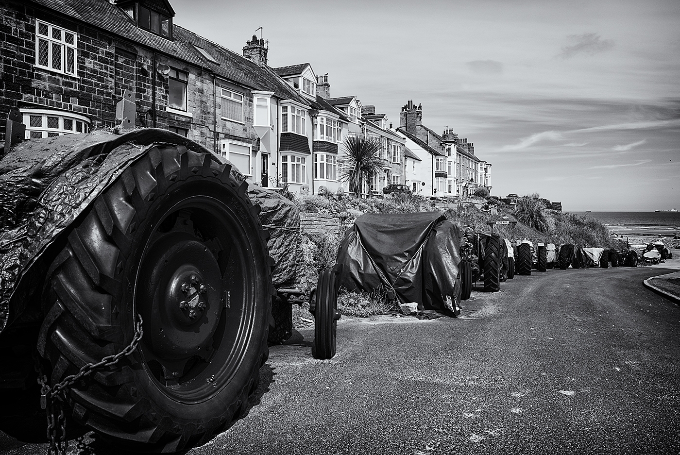


You must be logged in to post a comment.